Mile High Flood District
Offering broadly applicable digital-platform design practices combined with the modern web and cloud technologies to create user efficiency and ease in data sharing
 GIS Mapping
 Real-Time
 Reporting
The Mile High Flood District (MHFD) in Colorado comprises eight watersheds, including Denver and an area of 1,608 square miles. Like many government agencies, the MHFD was previously behind the technology curve and needed better ways to monitor stream management and watershed master planning efforts. Its data and information products were based on cumbersome PDF files and had become too difficult to comprehend because of file sizes and complexities. The capability to easily reference data, problems, solutions, improvements, and plans was crucial to streamlining MHFD operations. The MHFD’s traditional approach to information sharing was ready for a transformative technology makeover that would consolidate massive data and reduce excessive emails and phone calls among its 43 local government partners.
In early 2019, the MHFD reached out to its long-time advisor, RESPEC’s Denver office, to imagine a new approach to more closely align their operations with their capabilities for sharing technical and administrative processes. RESPEC introduced a client-engagement, design-center strategy—the Design Sprint methodology invented at Google Ventures—to quickly produce innovative pathways and solutions.
Confluence
Following the initial design sprint in 2019, the interactive web tool went into development, and Confluence was produced.
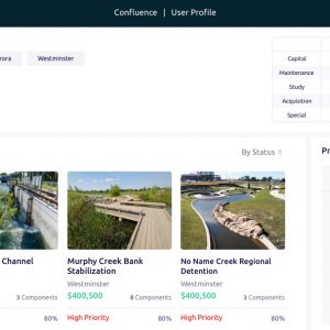
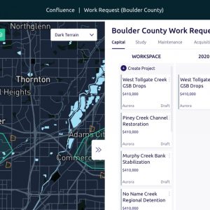
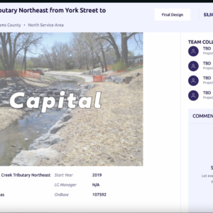
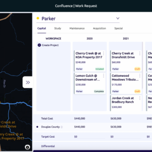
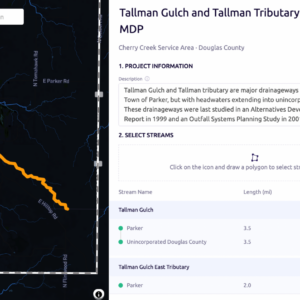
Confluence allows the Mile High Flood District to centralize project creation and coordination across the more than 40 districts within its purview. Local governments are able to suggest capital, maintenance, acquisition, and special projects in an easy-to-use, online mapping environment. Those projects are then routed immediately to the supervising manager from Mile High, after which he or she begins a project prioritization process whereby annual budgets are allocated and approved.
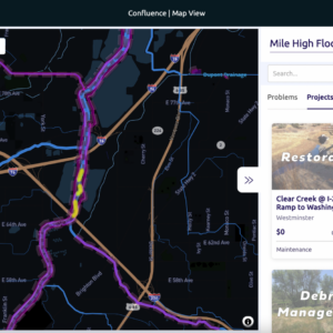
Confluence combines GIS mapping, project creation, budgeting, workflow coordination, reporting into a simple, modern interface with real-time access.
Features within Confluence include:
- Vector-Based Maps
- Desktop and Mobile Compatibility
- Custom Project Geometry and Creation Workflow
- Project Sharing via URL
- Project Export to PDF
- Data Integration with an ESRI Environment
- Synchronous Graphical Filtering
- Email Notifications
- User Management and Permissions by Role and Geography
- Project Prioritization by Year
- Project Budget Allocation by Year


Stay in Touch